
West Chicago ZIP Coverage
The researched postal evidence supports one primary West Chicago ZIP code, one secondary association, and one label that requires special caution. The USPS ZIP Code Lookup remains the authority for a specific delivery address. Postal sorting tables can show how mail is routed, but they do not create a city boundary or prove that a person uses the address.
| Postal label | West Chicago connection | Official facility or source | Research note |
|---|---|---|---|
| 60185 | Primary West Chicago postal ZIP | West Chicago Post Office and USPS labeling tables | Validate each full address because delivery and city limits differ. |
| 60186 | Secondary West Chicago association in 2026 postal tables | USPS sorting and labeling material | Exact street-service or post-office class was not established. |
| 60143 | Appears in a 2026 sorting scheme with a West Chicago destination | USPS sorting material | Do not treat it as a general city ZIP. Keep it only when USPS returns it for the exact address. |
| ZIP+4 | Address-level mail extension | USPS address result | Useful for mail form, not parcel identity or residency. |
This compact table is the heart of the West Chicago ZIP code directory. It deliberately avoids guessing neighborhood polygons or calling 60143 a normal West Chicago service area. No official source found in the research supplied a full polygon that reconciles every postal edge with the current city line.
West Chicago ZIP 60185
USPS identifies the West Chicago Post Office at 1130 W Washington Street, West Chicago, IL 60185-2622, with telephone 630-231-2020. The facility page lists weekday and Saturday access as well as available services. Hours can change, so use the live listing before a visit.
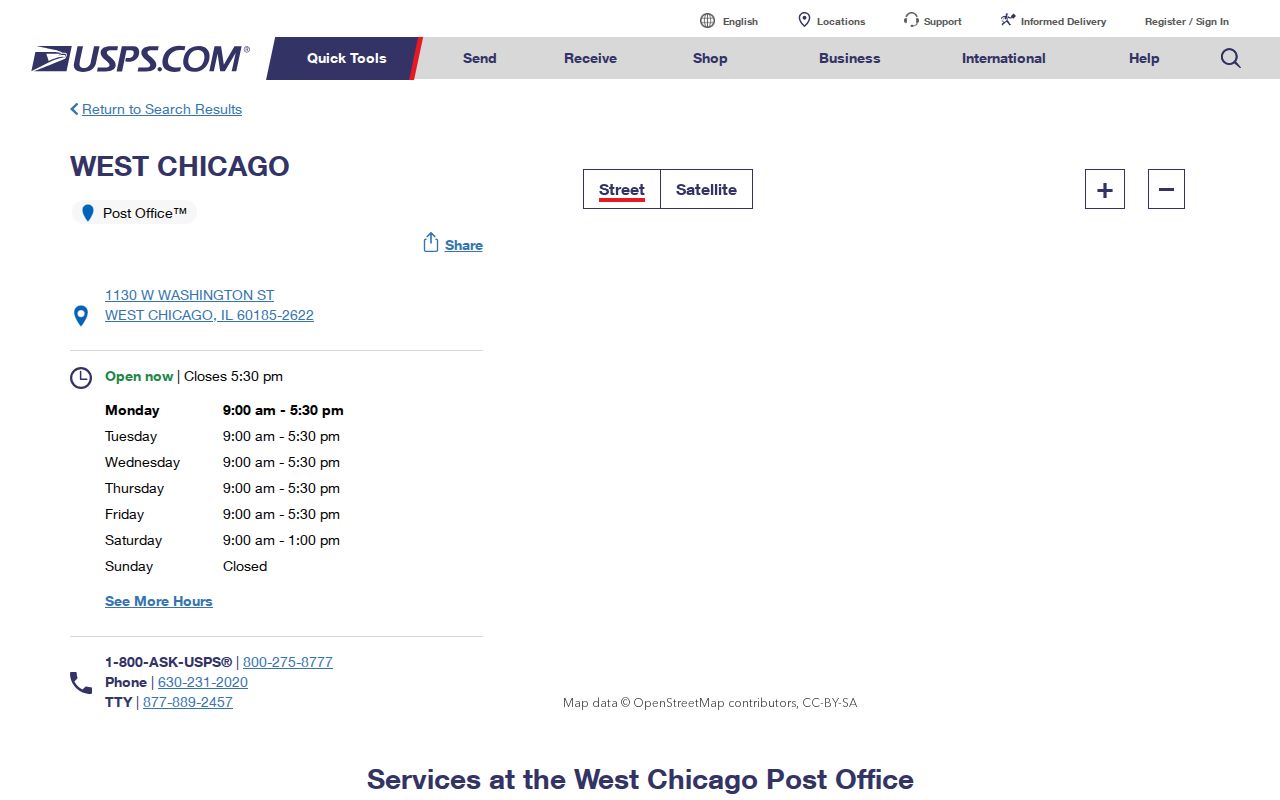
The facility confirms that 60185 is the primary West Chicago postal ZIP. It does not mean every address carrying 60185 lies inside the city, and it says nothing about the identity of an occupant. Search the full address to get a delivery result, then compare municipal jurisdiction separately.
A ZIP code directory is most reliable when it preserves that distinction. Postal evidence answers how mail is sorted. County and city records answer where a parcel sits and which agency keeps the related public file.
West Chicago ZIP Label Cautions
The 60186 and 60143 labels require different treatment. Current USPS sorting material associates 60186 with the West Chicago 60185 destination, yet the research did not establish whether a given 60186 record is a street-delivery address, post-office service, or another postal class. A user should not fill that gap with an assumption. Enter the exact address in the USPS tool and record the returned format.
The 60143 association is weaker for city-directory work. It appears in a sorting scheme connected to the West Chicago destination, but that routing link does not make 60143 a general city ZIP code. Accept it only when USPS returns it for the address under review. Then use county GIS to establish the actual parcel location.
This comparison is a local quirk with real search impact. Treating all three numbers as equal would widen a resident search with poorly matched results. The precise route is slower but far more useful.
Search West Chicago Postal Fields
The USPS tool offers three search paths. Address mode asks for a street address, city, and state. City-and-state mode returns ZIP codes linked to a locality. Cities-by-ZIP mode reverses the question and shows city labels for an entered ZIP. Each route answers a postal question. None verifies a parcel owner, current occupant, or municipal resident.
| USPS search mode | Information entered | Best West Chicago use | What it cannot establish |
|---|---|---|---|
| Find by address | Street, city, state | Normalize the full delivery address and obtain ZIP+4 when returned | Occupancy or parcel ownership |
| Find by city and state | West Chicago, Illinois | Review postal ZIP labels for the locality | Exact service area or city-limit polygon |
| Cities by ZIP | A five-digit ZIP | Check the preferred postal city wording | Legal municipal jurisdiction |
USPS location search has separate fields for street address, city or ZIP, state, facility type, hours, and distance. Those controls find postal facilities and services. They should not be repurposed as resident fields in a ZIP code directory.
Narrow West Chicago Residents by ZIP
Once USPS confirms the postal form, use the ZIP as a filter rather than a conclusion. DuPage Property Lookup can resolve an address or PIN, and its parcel card may show a property ZIP or mailing field. County GIS can test municipal location. A voter lookup has its own identity and legal-use controls and is not an open ZIP roster.
- Enter the complete street address in the USPS address lookup. Preserve the standardized city, state, five-digit ZIP, and ZIP+4 if shown.
- Search the DuPage Property Lookup by address. Open the matching PIN, which is the county parcel identifier.
- Compare the physical parcel address with the tax-mailing field. Label each one rather than merging them.
- Use the DuPage Parcel Viewer or city map to check whether the parcel sits inside West Chicago.
- After geography is settled, use only a record source suited to the actual question and retain its date and access limit.
If the goal shifts from a ZIP to every parcel on one road, the West Chicago streets directory explains the address-to-PIN path in full. That keeps this page focused on postal granularity.
Compare West Chicago ZIP Fields
A parcel system and a mail system may display similar text for different reasons. The situs address is the physical parcel location. A mailing address tells the county where to send tax material. A billing name is the name attached to that tax account. A recorded party appears in a deed or other instrument. None of those labels, by itself, is the same as a current resident.
DuPage Property Lookup offers PIN Search, Address Search, Billing Name Search, Map Search, and Board of Review routes. The parcel card includes map, legal-description, transfer, tax, assessment, owner, and mailing tabs. When a West Chicago ZIP code appears, capture the tab or field that supplied it. Do the same for a USPS result. A clean note might say “USPS delivery ZIP” or “parcel mailing ZIP,” not just “ZIP.”
- ZIP code
- A five-digit USPS routing code for mail delivery areas.
- ZIP+4
- A four-digit extension that narrows a delivery segment within the five-digit ZIP.
- Post-office-only service
- A postal arrangement used for boxes or other facility-based delivery rather than a mapped city neighborhood.
- Unique ZIP
- A code assigned to a single high-volume organization. The research found no confirmed unique West Chicago ZIP.
- Carrier route
- A mail delivery sequence used by USPS, not a city ward or parcel boundary.
West Chicago ZIP Versus Limits
Postal boundaries and West Chicago city limits serve different systems. USPS sorts delivery. The city administers municipal services and wards. DuPage County maps parcels, PINs, assessment data, and county layers. An address can therefore use West Chicago in its mail form while a county or city map tells a more precise jurisdictional story.
The official West Chicago home page is a route to municipal departments, mapping, and current notices.
The city source provides the government context that a postal lookup lacks. Check its live GIS information or contact staff when an edge address is unclear, then retain the county PIN and USPS result beside the city finding.
No definitive official ZIP-to-city-limit polygon was found during research. That is a real source gap. The sound method is exact-address validation across USPS, county parcel data, and municipal geography, not a guessed neighborhood boundary.
West Chicago ZIPs Meet Old Addresses
Historical searches add another layer. West Chicago was once searched under Junction, Turner Junction, and Turner. The city adopted the West Chicago name in 1896, while street renaming and a new building-number system arrived in 1930. A city directory entry can therefore show an old number or city label that no modern USPS result recognizes.
Keep the old wording exactly as printed. Pair a 1905 Sanborn map, the 1925–26 DuPage directory, later telephone or criss-cross volumes, and the current parcel legal description. USPS should normalize the current address only. It should not be used to rewrite the historical source.
That sequence explains why the West Chicago ZIP code directory must remain date-aware. Postal codes help with modern delivery and present-day filtering. Plats, deeds, directories, and maps preserve the older geography.
Use West Chicago ZIP Results Carefully
A ZIP-wide result can be broad, stale, or tied to a mailing address outside the physical parcel. Keep the source date and field label. Do not infer that a tax billing party lives at the situs address. Do not turn restricted election information into a general resident list. Illinois election law limits access and use, and sensitive fields are protected.
For a lawful personal search, the most useful chain is simple: postal address, parcel PIN, city jurisdiction, then a purpose-specific record. Stop when a protected or substitute address appears. The Illinois Address Confidentiality Program can provide an eligible survivor with a substitute address for new public records, and older property records may still exist. Trying to reverse such a protected address defeats the safety purpose.
The West Chicago ZIP code directory narrows geography. It does not certify residence. Verify each important conclusion with the government office that holds the underlying record, and never use a result to stalk, harass, or harm anyone.