
Walk a West Chicago Street
A reliable street directory search begins with the address itself, not a guessed name. Confirm the number, direction, suffix, unit, city label, and ZIP with the official postal tool. Then use the DuPage Property Lookup or Parcel Viewer to turn the street string into a PIN, the county's parcel identification number. That PIN stays useful even when an address has changed.
Work through the records in a set order. Keep the source date beside every name, and label each person as owner, billing contact, grantor, grantee, registered voter, or directory entry. Those roles are not synonyms for resident.
- Normalize the full address with the USPS ZIP Code Lookup.
- Match it to a PIN in DuPage Property Lookup, then open the parcel card and map.
- Browse the same street in the Parcel Viewer and note nearby parcel boundaries.
- Follow transfer entries and document numbers into the Recorder search.
- Use lawful voter access and dated criss-cross sources only as separate checks.
This sequence makes a West Chicago street directory useful without turning one public field into an unsupported claim about a household.
West Chicago Address Search Fields
The DuPage Property Lookup offers several paths into a parcel. Its public database may contain errors, and popup blocking can interfere with opening a card. An address result should be checked against its map, legal description, and tax year before it is added to street-directory notes.
| Search route | Input | Best use |
|---|---|---|
| PIN Search | Four PIN groups or ten digits | Open one known parcel |
| Address Search | Street number, name, city | Convert an address to parcel candidates |
| Billing Name Search | County name fields | Find a tax-mailing relationship |
| Map Search | Map selection | Resolve an unclear or changed number |
| BOR Hearings | Board of Review route | Find assessment appeal context |
A parcel card can expose tax, assessment, transfer, conveyance, legal-description, map, owner, and split/combine tabs. The billing name and mailing field still do not prove physical occupancy. That distinction is central to any West Chicago street directory.
West Chicago Address Labels Differ
Four similar-looking labels carry different weight. A situs address identifies the physical parcel. A mailing address tells the county where to send tax material. A billing name identifies a tax relationship. A recorded party appears on a filed instrument, which may be a deed, mortgage, easement, plat, lien, release, or trust transfer.
- Parcel
- A mapped unit of land identified by a county PIN.
- Situs address
- The physical address assigned to the parcel, which can differ from a mailing address.
- Plat
- A recorded map that defines lots, blocks, streets, or subdivisions.
- Criss-cross directory
- A directory arranged by address or phone number instead of only by surname.
The comparison prevents a common mistake: copying a tax contact into a list of West Chicago residents. Record the exact role and date instead. A later source can then support or disprove an occupancy link.
Browse West Chicago Parcels
The DuPage Parcel Viewer supports Basic Search by PIN or property address and Advanced Search by a partial street number and street name. Results persist until cleared. Drawing tools select by point, line, or polygon, and selected parcels can be exported as TXT, CSV, PDF, XLS, or XLSX. A selection may contain no more than 1,000 parcels.
The viewer also provides subdivision autocomplete, a historical-imagery slider, layers, Pictometry views, measurement tools, street-intersection search, and printable layouts. Layer dates matter. An older public parcel service says its spatial data is complete through assessment year 2016, while current real-estate data is joined weekly.
The county viewer is stronger for PINs, parcel geometry, assessment fields, and adjacent-parcel work. West Chicago's municipal GIS reports more than 150 Esri layers and is the better route for wards, city boundaries, infrastructure, and other municipal themes. Compare them instead of expecting one map to answer every street question.
West Chicago Municipal Map Layers
The West Chicago GIS page supplies the city contact route when a county parcel needs municipal context. It is especially useful when the issue is a ward, city limit, public asset, or city-held thematic layer. The public page did not expose a full field list during research, so a request should name the address, PIN, desired layer, and date.
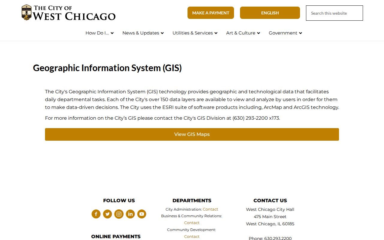
The captured city page shows where to seek municipal map help. It complements the parcel viewer; it does not replace the county's ownership and assessment record.
West Chicago Street Record Coverage
Address-keyed sources overlap, but their access channels and meanings differ. The street directory is strongest when the PIN, street form, document number, and date agree across systems. When a web portal fails, the office phone, counter, formal request, or library collection remains part of the search path.
| Address record | Custodian | What it establishes | Access route |
|---|---|---|---|
| Parcel and tax card | DuPage County | PIN, situs, tax and billing fields | Property Lookup, map, county help |
| Parcel geometry | DuPage GIS | Lot shape, district and nearby PINs | Public viewer, export, GIS contact |
| Recorded instruments | DuPage Recorder | Parties, type, date, legal description | Web index, office research, copies |
| City files | West Chicago | Permits, code or municipal context | City department, FOIA portal |
| Voter record | DuPage Election Division | Restricted registration confirmation | Official lookup under election law |
| Historical address entry | Libraries and archives | Dated name-to-address clues | Digital object, card access, reference visit |
The voter lookup is not an open roster. It requires identifying information and its use is limited by the Illinois Election Code. Street numbers, birth data, email fields, and other parts receive statutory protection. Never treat it as a way to harvest a block.
West Chicago Deeds by Address
The DuPage Recorder search accepts party names, a property address, PIN, document number, document group or type, and recorded-date bounds. Computer name searches begin in 1961, PIN searches in 1985, and address searches in 1995. Online indexed images begin in 1961. Office property research reaches to 1839, and plats extend into the 1800s.
Start from the parcel card's transfer history. Copy the instrument type, recorded date, document number, grantor, and grantee. Then search the Recorder by both names and the PIN. A grantee received an interest; that does not show that the person moved into the property. The legal description is often more stable than a street address.
If an image is absent or a pre-index instrument is needed, contact Recorder Research at 630-407-5401 or use the office at 421 N County Farm Road in Wheaton. The Recorder announced a portal migration effective August 14, 2026, so old saved links may change.
West Chicago Files by Street
West Chicago and DuPage Community Development may hold address-based files that do not appear in the tax or deed systems. The county's Accela APO lookup exposes Street Area, a number range, direction, street name, type, suffix, unit, city, state, and ZIP. The unusual Street Area field fits DuPage forms such as 22W435, where the prefix and number must be entered separately.
Anonymous Accela access is limited, and an account unlocks broader services. No complete permit coverage dates were found. Treat a result as a lead, then ask the custodian to confirm its status and date. A city administrative-adjudication file may document a code or property matter, but no searchable municipal case index was located. Its address can mark the cited site rather than a person's home.
When no online result exists, use the West Chicago FOIA portal. A focused request should state the street address, PIN if known, date span, record series, and whether inspection or copies are preferred. Illinois FOIA normally calls for a response within five business days and permits an extension of up to five more under the statute. Exemptions, redactions, and reproduction charges can still apply. This request route is the fallback for a permit, code, map, or city file that the public search does not expose.
The DuPage address and owner lookup shows the fields available before a user opens a record.
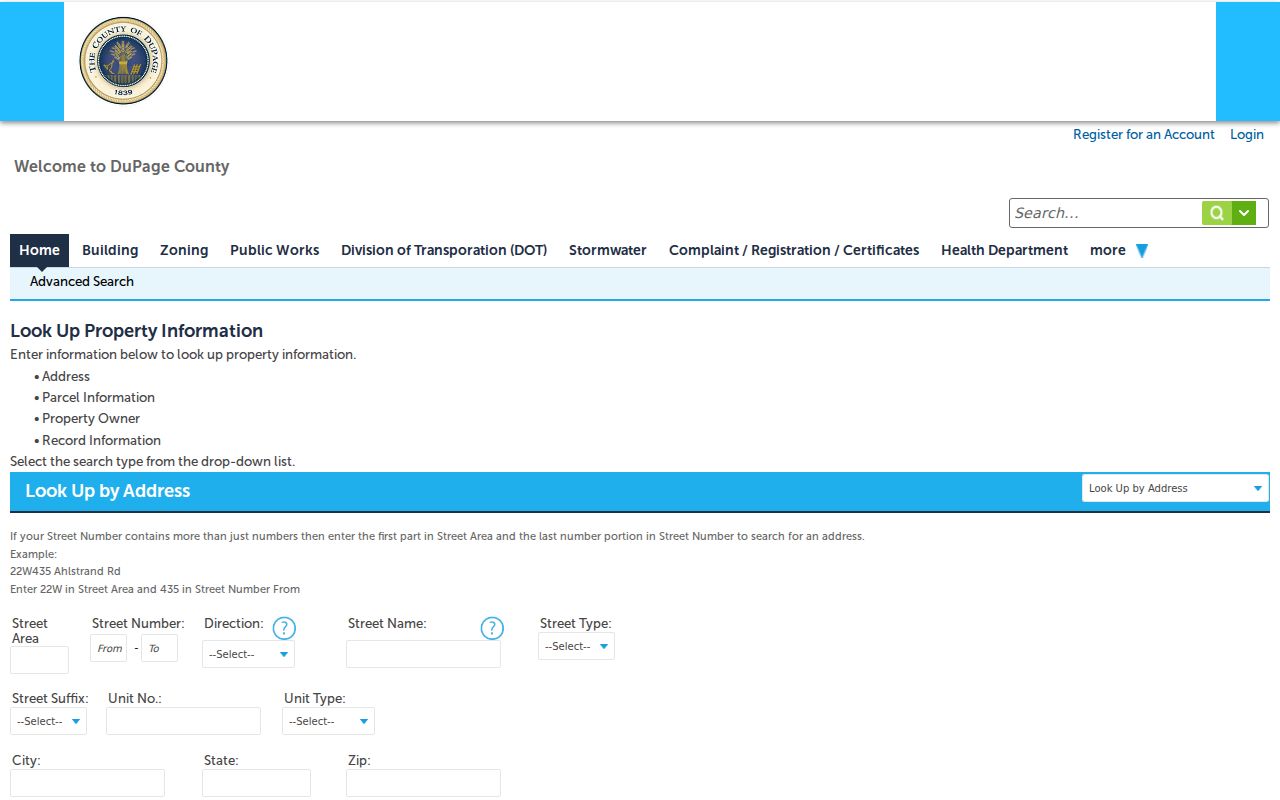
The image helps explain how area prefixes, directions, suffixes, and units can change a West Chicago street-directory result.
West Chicago's 1930 Address Shift
West Chicago adopted renamed streets and a new building-number system in 1930, after the concrete-street work of 1923 to 1925. Older research may also use Junction, Turner, or Turner Junction, reflecting the railroad settlement's earlier names. A direct modern-address search can therefore miss the correct 1905 map or 1925–26 directory entry.
Use the current PIN and legal description as anchors. Compare the 1905 Sanborn map, the 1925–26 DuPage directory, later phone books, and current GIS. No official old-to-new address crosswalk was located. If the map and directory still do not align, request a historic numbering or map record through City GIS or the West Chicago records portal.
This local quirk is why a street directory must preserve the wording printed in each old source. Do not silently modernize a street name or expand an initial.
Limits of West Chicago Street Records
No single public roll shows everyone who lives at a West Chicago address. Parcel cards identify land and tax relationships. Deeds show interests conveyed. Postal data standardizes delivery. Voter data has strict access and use rules. Directories are snapshots that can omit people, and city case files may use a service or incident address rather than a home.
Use at least two independent sources before connecting a name to an address. Preserve the date, source, and role. For historic occupants, the full collection detail belongs on the West Chicago city directory page; for a full named street, keep the present search grounded in parcels and dated official records.
Lawful use. Use West Chicago address records for careful personal research. Never use them to stalk, harass, intimidate, or expose a protected address.
The Illinois Address Confidentiality Program can provide eligible survivors with a substitute address for new public records. It does not erase all older property records. Stop if a result appears protected, and ask the custodian how it should be handled.